Hotline: +84 948 65 56 36


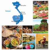
Vietnam Geography
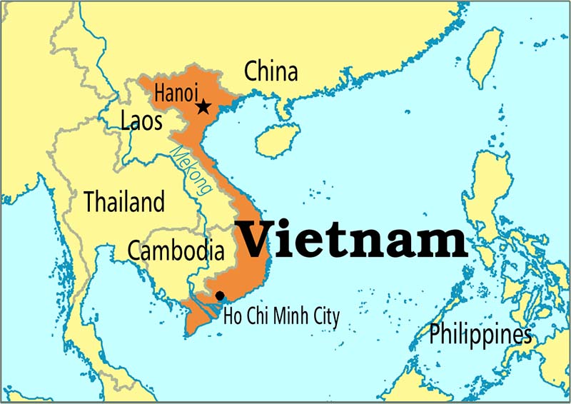
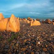
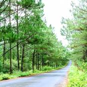
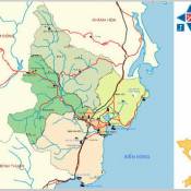
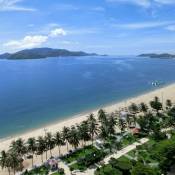
Located in the southeast of Indochinese Peninsula Vietnam has 4,639 kilometer-long boundary on land and a coastline of 3,260 kilometers long. Lower from the northwest to the southeast, Vietnam has the diverse topography with mountains, hills, plains, coasts and continental shelf.

the North is mountainous, while the Central Vietnam has the largest difference in height between the east and the west, and quite simple topography with Mekong Delta in Southern Vietnam. Thus the Vietnam's climate also changes and different from the north to the south which has two main climate regions, the tropical monsoon climate with four seasons in the North and the typical tropical climate with two separate seasons in the South.
Vietnam Location
Vietnam is located in the southeast of Indochinese Peninsula and covers an area of more than 330,000 square kilometers (128,000 square miles). The country has the shape of letter "S" and lies entirely in tropical region, between latitudes 8°27' and 23°23'N, and longitudes 102°8' and 109°27'E.
Vietnam shares the borders with the Gulf of Tonkin and South China Sea to the East; Laos and Cambodia to the West; China to the North and the Gulf of Thailand to the South. Vietnam has 4,639 kilometer-long boundary on land and a coastline of 3,260 kilometers long. Vietnam’s territory on the sea occupies an area of about 1,000,000 square kilometers.
Vietnam Topography
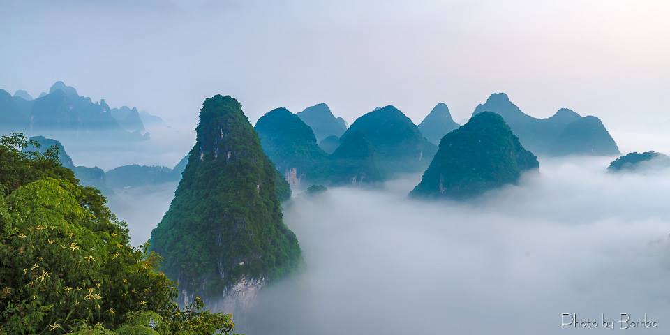
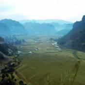
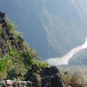
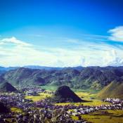
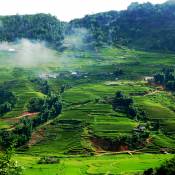
Vietnam's topography is very diverse with mountains, hills, plains, coasts and continental shelf. It's result of tectonic process in a long time of millions of years in the past. The topography is lower from the northwest to the southeast. Thus, almost the rivers in Vietnam have the stream following that direction.
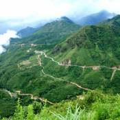
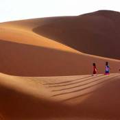
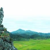
Mountains and hills, which occupy three quarters of Vietnam’s territory, are the main landscape in Vietnam. However, 85% among them are low mountains and hills under 1,000 meters high. There are only 1% of mountains that have the height over 2,000 meters.
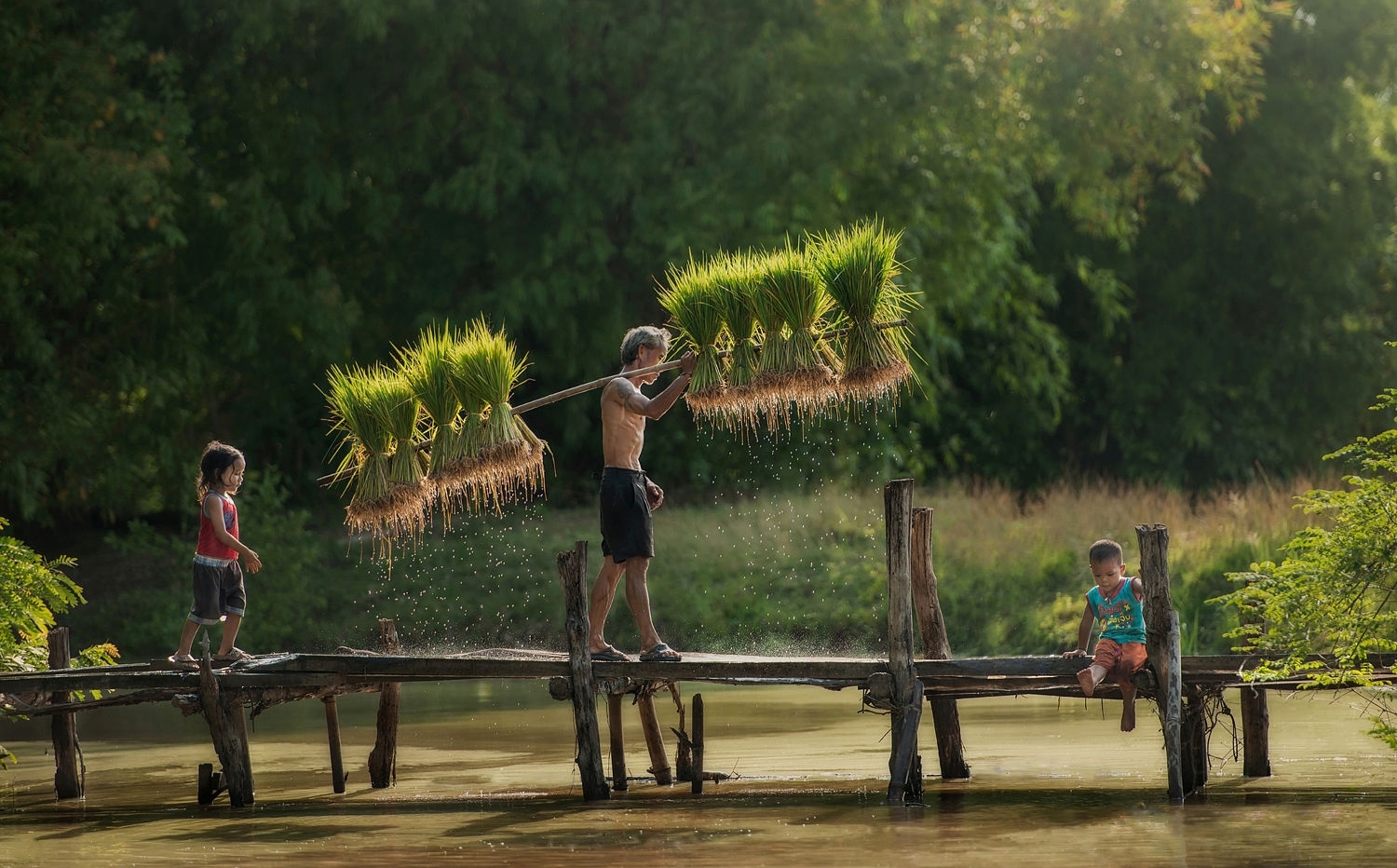
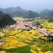
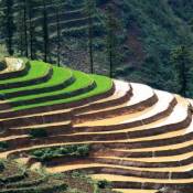
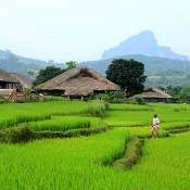
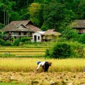
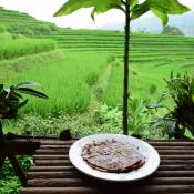
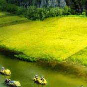
In northeastern Vietnam, there are several mountain ranges (such as Song Gam, Ngan Son, Bac Son and Dong Trieu) forming the shape of a bow. In northwestern Vietnam, high mountains and highland are the dominant scenery. This region is also location of the highest mountain of Vietnam – Fansipan (3,143 meters high), which is dubbed "the Roof of Indochina". In the central of the Northern part of Vietnam is the Red River Delta, one of two biggest plains in Vietnam. The Central Vietnam has the largest difference in height between the east and the west. The west is featured with high mountain range of Truong Son and Tay Nguyen’s highlands, while the east has various small plains along the coast. In Southern Vietnam, topography is quite simple with Mekong Delta, the largest plain of Vietnam (or “Nine Dragon River Delta”). Mekong Delta covers an area of 40,000 square kilometers in total and is the main rice-cultivating area of Vietnam.
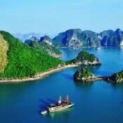
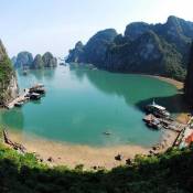
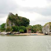
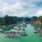
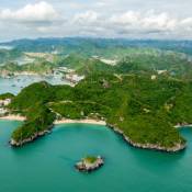
Vietnam’s territory on the sea is featured with variety of islands with both small and big size. The gulf of Tonkin, in particular, comprises more than 3,000 islands, which belong to Halong Bay, Bai Tu Long Bay, Cat Ba Island, Bach Long Vi Island, etc. The two biggest archipelagos of Vietnam are Truong Sa Archipelago (Spratly Islands) and Hoang Sa Archipelago (Paracel Islands).
Vietnam Climate
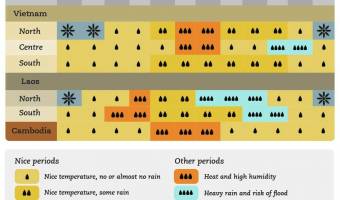
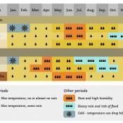
Vietnam's climate is typical for the tropics: the weather all around the year is in high temperatures and humidity. In particular, Vietnam's climate regions include two main climate regions: the North and the South with the boundary is Hai Van Pass.
In the North, climate is tropical monsoon climate and has four distinct seasons including spring, summer, autumn and winter. Climate in the North shows continental character clearer than that in the South. When northeastern monsoon is active (from November to March), it’s the winter and the weather becomes cold and dry. The temperature is lowest in December and January. On some mountains in the North such as Sapa, Tam Dao, Hoang Lien Son, etc, it can down to 0°C and have snow.
In the South, climate is less affected by monsoon operations. Thus, tropical character is more typical than in the North with two separate seasons: dry season and rainy season. The temperature in the South is quite stable and remains high all year round.
Beside climate division from the North to the South, the climate also has differences between low and high areas as given structure of terrain. It was formed sub-climate regions like Sapa (Lao Cai Province), Da Lat (Lam Dong Province) with temperate climate.
The average temperature of Vietnam ranges from 21°C to 27°C, and increases from the North to the South. The average annual rainfall is from 1,500 – 2,000 mm and humidity is around 80%. As the impact of complex terrain, monsoon operation and the sea, Vietnam usually suffers extreme weather phenomena such as hurricanes, floods, droughts. Statistically, there about 6-10 storms and tropical depression landed in Vietnam each year.
Votre message
Nom et prénom complet
Courriel
Code anti-spam
Mời bạn đăng nhập để bình luận


- Info Viet nam
- NEWS
- Destination
- Testimonials
Find everything you are looking for about our country - Vietnam
About tourism, history, culture, manners and customs, traditions of Vietnam
Best Time To Visit Vietnam
Vietnam Overview

Vietnam Geography

Vietnam History
Vietnam Government and Politics

Vietnam Economy
Vietnam Demographics

Vietnam Customs

Vietnam Art Performance
Vietnam Religions
Ce sont de nos blogs sur les circuits Vietnam ou les sites internets partenaires&l
Immense Paddy Fields in Bac Son Valley
Explore Hon Tre Island in Kien Giang

Innocent Kids in Mu Cang Chai
Da Lat Railway Station
Elephant Trek in Ban Don
Most Beautiful Mong Village in Southeast

Bird Island in Quang Binh
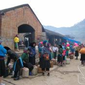
Market Sessions in Ha Giang

Historical Destinations Featured on Vietnam Banknotes

Buffalo Market in Lao Cai
100-year-old Villas in Da Lat
Cuisine Culture of Cham People
What to Eat in Phu Quoc

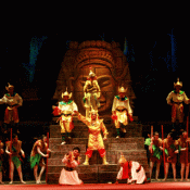
Traditional Tuong Theatre must be Preserved

Climbing Ba Den Mountain Summit

Cho Tay, A Highlight Attraction in Hanoi
Sa Pa Travel in Winter Weather

Ham Rong Mountain, Wonderful Flower Garden in Sa Pa

Discovering the Beauty of Quan Lan Island

Binh Dinh Approves Eco-friendly Electric Cars for Tourists
A Day in Bat Trang Ceramic Village
Tu Lan Caves to Welcome Tourists in November 10
Visiting Ha Giang
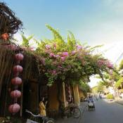
Cultural Diversity in Hoi An
Enjoyable Time in Cuc Phuong National Park
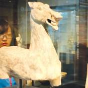
VN Museum Presents Rich Asian Cultures

Bac Lieu Hosts National Cai Luong Competition
Co Thach Beach, A Pristine Beauty
Discover A Different Quang Nam to the West

French Photographer Sells Viet Nam-theme Photo for 10,000 euros

T’way Air to Launch Incheon - Ho Chi Minh City Flight
Characteristics of Thai Ethnic Group in Vietnam
Sad Love Story of Male Cave and Virgin Cave

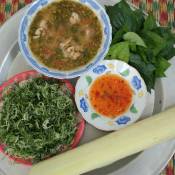
Kiem Soup, Specific Vegetarian Dish in South Region

Pi Le Pipe, Unique Musical Instrument of Tay Ethnic Group

Vietnamese Lip Lute Gets An Ambassador

Ritual Craft Becomes Folklore Art

Dressed to Impress
Experts Offer Suggestions to Remove Scripts on Halong Bay Caves

Stir-fried Noodles with Sliced Pork (Mì Xào Thịt Heo Lát)

Top Places for Snorkeling in Vietnam
Tips for Hoi An Travel on Tet Occasion
Vietnamese Water Puppets Perform Danish Fairy Tales
Mui Ne, Ideal Place for A Perfect Holiday
Tu Van, Unique Shell Pagoda
Dong Ngac - The Ancient Village outside Ha Noi
Lao Cai Enhances Agricultural Product Quality for Tourists

Jetstar Pacific Opens Flights Linking Hue & Da Lat

Cheap Rail Tours Start in Ho Chi Minh City

Lufthansa Cargo Opens Flights to Ho Chi Minh City

Famous Street Food Stalls in Hanoi - Vietnam

Passport and Visas for Laos
Laos Weather and When to Go

Seaplane Tours to Ha Long Serve 3,500 Passengers in A Year

Banh tet, Traditional Food on Tet Holidays
My Long Rice Paper - Ben Tre’s Special Food

Tea Festival Attracts International Participants

Viet Nam Airlines to Launch Hai Phong - Nha Trang Service
Gu Bla - Unique Sculpture of Cor People

Xoi gac-gac, Fortunate Red of Vietnam

Famous Street Food Stalls in Hanoi

Explore Vietnamese Cuisine with Gordon Ramsay

VietJet Air Offers “Golden” Deals
Cu Chi Tunnel Enters Top World’s Most Attractive Underground Architectures
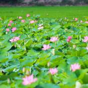
Floating in Paradise of Lotus

Dong Da Festival, Pride of Vietnamese people
Oxen Race at Khmer Dolta Festival

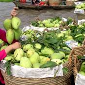
Nha Trang Mango Cake
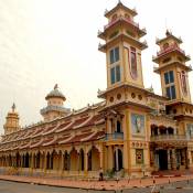
Giac Lam Pagoda, Must-visit Spiritual Attraction in Saigon
Destination at A Glance: Vietnam

Enjoy Ha Noi Pho Like the Gourmet

Experience Stand Up Paddle Boarding in West Lake
New Cruise Ship to Can Gio Launched

Must-dos in Hoi An

A Guide to Vietnamese Coffee
Banh Duc, Rustic Snack in Vietnamese Cuisine

Earings of the Mong in Son La

7 Best Tailors of Hoi An

Crary House in Da Lat

Tuan Chau International Port Comes into Operation

5 Tips for First-time Travelers to Vietnam

Da Lat Jam, Sweet Gift for Your Family

Vietjet Air Opens Ho Chi Minh City-Yangon Route

Chapi Musical Instrument Reflects the Raglai Soul

Top 6 Must-do Things in Cat Ba Island

The Necklaces of Co Tu Men
Citadel of the Ho Dynasty

Banh Com - A Fine Treat of Ha Noi

Quang Ninh Museum and Library

Bien Ho - The Eyes of Central Highlands
Spinning tops (Con quay) - A folk game
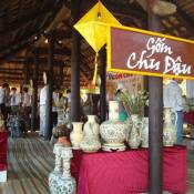
“Chu Dau” Ceramic - Vietnamese cultural quintessence

Five Destinations Worth to Visit on Tet
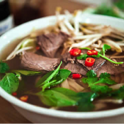
“Pho” - the Most Iconic Dish in Vietnam
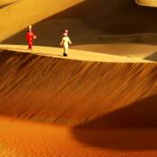
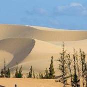
Immense Sand Dunes in Ninh Thuan
Kites that Make Music (Dieu Sao)
Traditional Festival in October

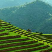
National Week Honours Mu Cang Chai Terraced Paddy Fields

Five Markets in Sai Gon Especially Loved
Cat Ba Cliffs and Rock-climbing Enthusiasts
Hanoi Cheo Theatre
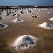
The Beauty of Hon Khoi Salt Field
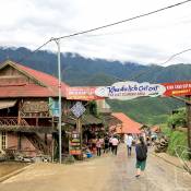
Northern Mountain Area of Vietnam

UNESCO World Heritages In Vietnam


Ninh Binh Retains Values of Trang An Complex

Fish Massage: A Fishy Way to Unwind in Vietnam
Da Nang cuts prices to draw tourists
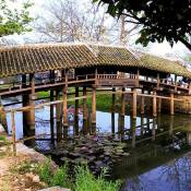
Thanh Toan Tile-roofed Bridge in Hue

First Buckwheat flower festival to be held in Ha Giang

American reporters lured by Vietnamese cuisine

Palace of Nguyen Dynasty’s last king re-opens after renovation

Melt with the clip "Welcome to Vietnam”
Things to see in Sapa

Vietnam Airlines Opens Nha Trang - Hai Phong Route
Lao Cai Begins Trial Run of National Park Expeditions
Visiting Bao Dai’s Villa in Do Son
Event Schedule in Visit Viet Nam Year 2016 - Phu Quoc - Mekong River Delta
Best Beaches in Vietnam
Sapa and villages minorithes
Bac Ha Market, Can Caua Market, Cao Son Market, Lung Khau Nhin, Coc Ly Market, Sin cheng Market

Van Mieu Doctoral Steles Recognised as National Treasure

Vietjet Inaugurates Ho Chi Minh City - Seoul Flight
Events Celebrate Khmer’s Ok-Om-Bok Festival
Conquering Toi Cave (Dark Cave) in Quang Binh

Lady Thu Bon Festival
Ha Giang is Amazing through Pictures of Backpackers

Explore Charming Beauty of Tu Lan Cave
Ben En National Park in Thanh Hoa

Visiting Phan Thiet from A Different Perspective

Thai Phien Flower Village in Dalat

Ha Noi and Ho Chi Minh City Listed in Top 10 World’s Destinations with Reasonable Cost

Vietnam Airlines to Offer Promotional Tickets for Tet Festival
Mang Den Eco-tourism Area in Kon Tum
Visit Tan Trao Special National Historical Relic

Ba Ria - Vung Tau
Peaceful Tha Village
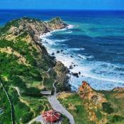
Con Dao Welcomes more Tourists as People Flood to Island Paradise
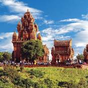
Exploring Cham Culture at Po Klong Garai Tower
Destination
Binh Dinh

Ho Chi Minh City and Around

Chau Doc - An Giang
Vung Tau Travel Guide
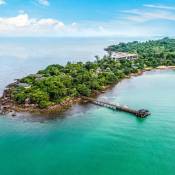
Discover Phu Quoc Island

The Southern-most Province, Ca Mau
Ninh Thuan Province
Soc Trang
Binh Duong
Introducing Ben Tre
Can Tho Province
Beauty of Dong Thap
Information of Tay Ninh
Everything about Quy Nhon
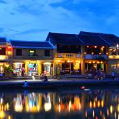
Hoi An Ancient Town

Da Lat - Valley of Love
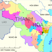
Thanh Hoa Province

Modern Da Nang City

Phu Yen in Vietnam
Best thing of Mui Ne
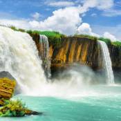
Dak Lak in the Center of Tay Nguyen

The Charm of Hue
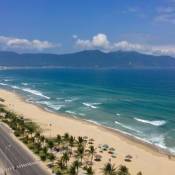
Nha Trang, Most Famous Seaside Resort-town
About Nghe An Province

Introducing Cao Bang

Thai Nguyen Province

Lai Chau - A Beautiful Moutainous Land
Dien Bien Phu with Heroic History
Hoa Binh Travel Guide

Nam Dinh Travel Guide
All About Lang Son Province

Bac Ninh Province’s Attractions
Phu Tho Province
Hai Phong Travel Guide
Bac Kan Province
Introducing Son La Province
Ninh Binh Travel Guide

Ha Giang Vietnam
Sapa Vietnam

Halong Bay and Grotto System and Island
Cat Ba Island
Hanoi Vietnam
Merci à tous les anciens voyageurs qui ont fait le Compte rendu de votre voyage !!!
Chers futurs voyageurs, si vous avez des questions sur notre agence, n’hésitez pas à contacter directement ceux qui ont déjà testé nos services.